
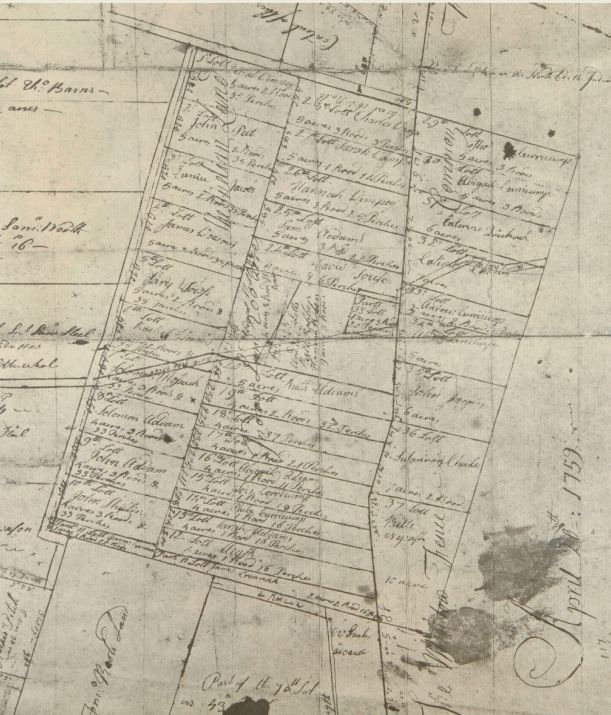
Plan of Tunxis Indian lands, Farmington, 1759
Plan of Tunxis Indian lands, Farmington, showing the allotment of once commonly held lands into individual plots, 1759. Early Maps of Farmington, Conn., Part 2, Town Clerk’s Collection, 1935. Photograph by Brian Parker – State Archives, Connecticut State Library – See more at: http://connecticuthistory.org/breaking-the-myth-of-the-unmanaged-landscape/#sthash.t2JX2tko.dpuf